Riding the Sweden & Norway Trans European Trail
If you crave the wild over the well-trodden, and you’d rather camp beside a glacier than queue at a viewpoint, then the Norway and Sweden sections of the Trans Euro Trail (TET) will feel like home. This is a route built for riders who live for solitude, scenery, and a bit of dirt under the tyres. And yes—even if you're a beginner, with the right mindset and gear, this ride is absolutely within reach.
What is the TET?

The Trans Euro Trail is a vast, interconnected network of off-road and gravel routes covering over 100,000 km across Europe—crafted by and for the adventure motorcycle community. It’s a grassroots project built on passion, exploration, and the spirit of freedom. The Norway and Sweden sections stand out as some of the most remote, raw, and visually striking. Here, riders can expect to traverse deep forest trails, climb rugged mountain passes, and weave alongside waterfalls, rivers, and glacial fjords. It’s an ever-changing, immersive landscape that demands your attention and rewards your effort. For any rider—beginner or seasoned—this is an experience that should top the bucket list.etwork of off-road and gravel routes spanning 100,000km’s across Europe, created by and for the adventure motorcycle community. The Norway and Sweden sections are some of the most remote and scenic, offering a blend of forest trails, mountain passes, and endless wilderness. Riding through forests, mountains and passing waterfalls, rivers and fjords. For any rider this should a must!
Why Ride It?
The TET lets you dive deep into the untouched wilderness of Norway and Sweden—far from traffic, tourist coaches, and crowded viewpoints. Instead, you’ll find yourself threading through forests, cruising past waterfalls, and winding along gravel roads that hug glacial rivers and fjords. For fans of the silver screen, you might even recognize some of the stunning backdrops featured in No Time to Die, where 007 himself raced through Norway’s northern wilds.
What makes this route truly special is its balance of remoteness and reassurance. You’re off the beaten path, but still close enough to civilization to refuel, resupply, or sort out an issue if needed. Fellow bikers appear just often enough to remind you you’re part of a quiet, roaming community—but for most of the ride, it’s just you and the land.
Riding the TET here is a way to see Scandinavia stripped back and uncrowded, exactly as it should be. Whether you’re in it for the solitude, the scenery, or the slow-burning satisfaction of tackling each day at your own pace—this ride is something you’ll carry with you long after the engine cools.
For the adventure motorcyclist, this isn’t just a route. It’s a reset.


Best Time to Ride
The ideal time to tackle the Norway and Sweden sections of the TET is between June and early September. Snow can linger on mountain passes well into late spring—especially in Norway—making some routes impassable earlier in the season. By mid-June, most trails are open, and the weather becomes more reliable.
July brings long days and the midnight sun in the far north, giving you more time to ride and explore. However, it’s also the busiest month for local holidays, so you might encounter more traffic around towns and tourist hotspots (though still minimal compared to southern Europe).

August to early September is arguably the sweet spot—fewer bugs, thinning crowds, cooler temperatures, and golden evening light. The landscapes start to shift into autumn colours, and you’ll still get long daylight hours for extended riding.
Avoid riding past mid-September unless you're prepared for unpredictable weather, colder temps, and the risk of early snow at higher elevations.
How experienced do you need to Ride the TET?

You don’t need to be a hardcore off-roader to enjoy the Norway and Sweden sections of the TET—but having basic off-road skills and a bit of confidence in remote settings will serve you well. Most of the trail is made up of gravel roads, forestry tracks, and light trails, making it manageable for riders with beginner to intermediate experience who are comfortable with loose terrain.
That said, conditions can change quickly. A sunny stretch can turn into slippery mud or deep ruts after a rainstorm. Surfaces vary from smooth hardpack to loose stones and occasional rocky or washed-out patches. If you're new to adventure riding, pace yourself. Focus on foundational skills like throttle control, slow-speed balance, and standing posture. There’s no shame in rerouting if a section doesn’t feel right—this ride is about enjoyment, not ego.
Preparation matters. Bring plenty of water, carry extra fuel where distances are long, and keep a basic toolkit and first aid kit handy. Be sure to pack extra inner tubes, a puncture repair kit, and tyre levers—flats are common on rough terrain, and being self-sufficient can save hours of waiting or walking. A compact battery booster is also highly recommended, especially if you're running auxiliary gear or riding solo—dead batteries in remote areas can turn into serious setbacks. Navigation can be tricky in remote areas, so a GPS with offline maps or a loaded GPX track is essential.
The TET is as much about mental endurance as it is about skill. Stay calm, stay flexible, and embrace the surprises. You’ll build confidence with every mile—and earn some serious bragging rights along the way.
Wild Camping
In Norway, Sweden and Finland recognizes “the right to roam” making wild camping legal and a fantastic way to tour Scandinavia. There are also many structures that you can stay in the cater to people wild camping in the wilderness. Some are only reachable by hiking but many are also accessible by two wheels (or more).
Rules & Considerations to Abide By:
Distance from Buildings: You must stay at least 150 meters away from any inhabited house or cabin.
No Damage or Disturbance: Avoid damaging the environment or disturbing others.
No Farmland: Avoid private properties, meadows, pastures, gardens, and agricultural land.
Limited Stay: You can stay in one place for up to two nights without permission.
Fire Restrictions: Campfires are prohibited from April 15th to September 15th.
Respect Nature: Pick up your trash and leave the area as clean as you found it.
No Harassment: Don't disturb animals or nature.
Wild Food: You may pick wild berries, mushrooms, and wildflowers for your own consumption, but be cautious about edible and inedible varieties.
Fishing: Fishing for saltwater fish is generally allowed without a license, but you'll need a license for freshwater fishing.
Longer Stays: If you plan to stay for more than two nights in the same location, you should ask for the landowner's permission.
Helpful Apps and websites to find spots ahead of time:
iOverlander - download for Apple/Android
CampWild - website


Gear Tips
Success on the TET often comes down to smart packing and reliable gear. Here are some essential tips to keep you comfortable, capable, and safe on the trail:
Tyres: Go for aggressive 50/50 or full knobby tyres. You'll encounter a mix of loose gravel, wet clay, and sharp rocks—good grip is non-negotiable.
Luggage: Soft panniers are lighter and more forgiving in falls, ideal for narrow forest trails.
Riding Gear: Waterproof and breathable layers are essential. Bring a quality rain suit, riding gloves with good dexterity, and base layers that dry quickly.
Tools & Spares: Bring a well-rounded tool kit, tyre levers, spare tubes, a puncture repair kit, and chain lube. Don’t forget a compact jump starter, spare fuses, zip ties, duct tape, and basic spanners or sockets suited to your bike.
Fuel & Water: Carry extra fuel if you're venturing into remote sections—range anxiety is real. Always bring more water than you think you’ll need, especially in warmer months. A hydration bladder plus backup bottles is ideal.
Water Filtration: A compact water filter or purification tablets let you safely refill from streams or roadside sources, adding flexibility and peace of mind.
Navigation: A GPS device with offline TET tracks is a must. Backup paper maps and a compass aren’t a bad idea, either.
Camping Kit: A lightweight tent, sleeping bag rated for colder temps, compact stove, and water filter let you wild camp anywhere comfortably.
Power: A USB charger connected to your bike, plus a small power bank, ensures your gear stays charged even if your battery doesn’t.
Efficiency, durability, and weight matter—pack smart, not heavy.
GPX Files

You can download the official GPX tracks for the Norway and Sweden sections of the Trans Euro Trail directly from the Trans Euro Trail website. The site is community-run and regularly updated by country-specific Linesmen, ensuring routes are legal and rideable.
Once downloaded, you'll need a GPX-compatible navigation app or device. Here are a few top options:
OsmAnd+ – Great for offline maps and navigation with custom GPX support.
Kommoot – User-friendly interface, with route planning and offline functionality.
Gaia GPS – Excellent for planning and tracking off-road routes.
Garmin BaseCamp + Garmin GPS unit – Reliable and rugged for remote areas.
Drive Mode Dashboard (DMD2) – Popular with adventure riders using handlebar-mounted Android devices.
Outdooractive – A great all-round app with detailed topo maps, hiking and biking routes, and GPX import support. Excellent for planning multi-day adventures in Scandinavia.
Make sure to preload your maps and tracks while you have internet access. It’s also a good idea to carry a power bank and backup device, just in case.
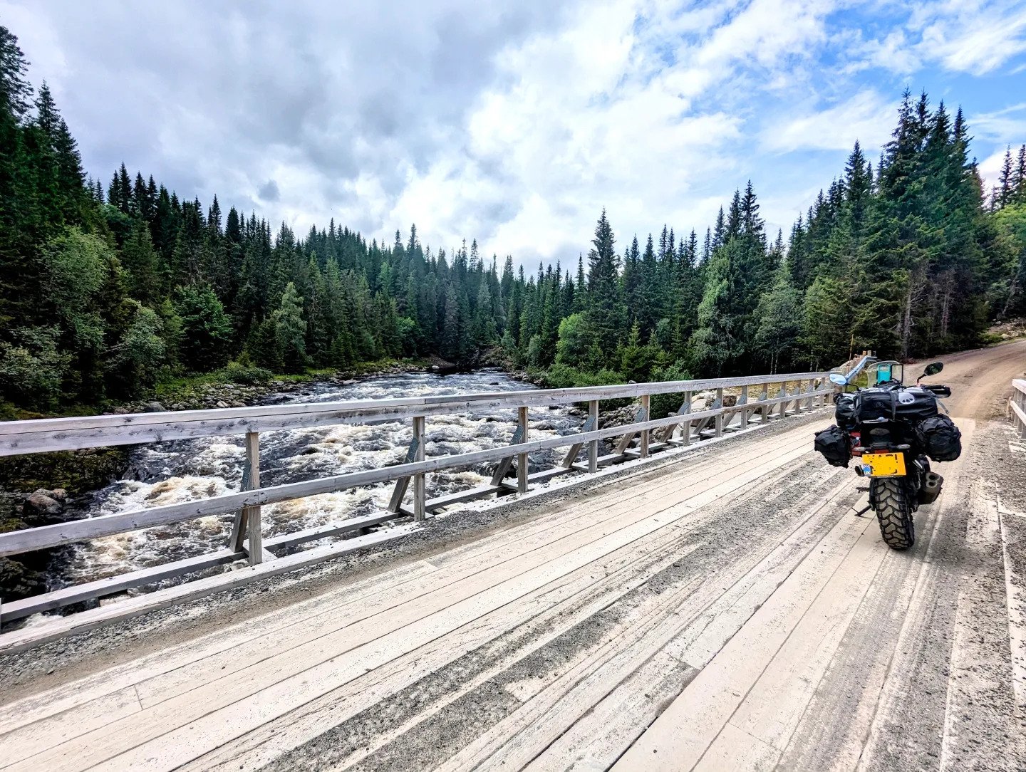
The Route
Officially starting my journey from Copenhagen, I crossed the Oresundsbron Bridge into Sweden joining the Sweden Trans European Trail (TET). I took the TET in Sweden to the Norwegian border just north of Oslo at which point I hopped onto the Norwegian TET for an almost circular route before heading back into Sweden. I continued on the Sweden TET with a couple diversions specifically for Flatruet. The highest road in Sweden. The route options for the Sweden TET have grown considerably since I travelled there so there are many routes to try for your own adventure. I will say that the Sweden TET does very much become very same-same landscape wise to the point where I ended up pushing through and hitting the tarmac to join back onto the last bit of the Norway TET in the arctic circle. I find that in comparison the Norwegian TET landscape changes very dramatically very quickly so once having a small taste you want to go back.


Trans Euro Trails Maps

Sweden start after crossing the bridge in Copenhagen.

Crossing into Norway just north of Oslo for the Norway TET.

Joining back onto the Sweden TET to continue North.

The last portion of the Norwegian TET to Nordkapp.
Must Not Miss
Jotunheimen National Park
What: A beautiful scenic road glides through this National Park that easily adds onto the Norwegian TET
Where: Fv51, 2953 Beitostølen, Norway (61.9204, 9.3385)
Notes: The weather is very temperamental. Even in the middle of summer so be prepared. Make sure you save sometime to just enjoy the area. I felt like I rode through to quickly and I need to return.


Blåhø Mountain
What: A mountain located enroute of the Norway TET. The road up is beautiful scenery. Don’t miss it!
Where: Unnamed Road, 2663, Vågå kommune, Norway
Notes: This route is amazing. The scenery changes drastically very quickly as you ascend the mountain. Unfortunately I arrived in Norway just after a storm so due to roads being washed out I had to take multiple detours instead of following the trail directly. Fortunately in Norway it’s very easy to find some dirt tracks to keep you entertained.
Rondane National Park
What: Is the oldest national park in Norway located in the Innlandet county. It contains ten peaks over 2,000 metres and is an important habitat for herds of wild reindeer.
Where: Innlandet County, Norway
Notes: Wonderful area to wild camp, hike and ride around.

Grimsdalen Valley
What: What locals consider to be the most beautiful vallei’s in Norway. Truly, the views are spectacular!
Where: Hedmark County, Norway
Notes: Beautiful spot to wild camp.

Flatruet
What: Considered to be the higheset public road in Sweden. Ascending to a mountain plateau at an elevation of 964m.
Where: Jamtland County, Sweden
Notes: A gravel track road that could easily be done on a road bike. Be wary of reindeer, this seems to be a hotspot for them as they are constantly darting across the road. This landscape was very different compared to the rest of my tour but worth a small detour off the TET if you have the time.

Nordkapp 71º 10' 21" -
What: Northern most point in Europe that can be accessed by car.
Where: Northern Coast of the island of Magerøya , 71°10′21″N 25°47′04″E
Notes: A visit to Nordkapp comes with an entrance fee to access the visitor centre and monument, which has extended hours during certain seasons to let tourists catch the midnight sun. On some nights, it stays open as late as midnight.
If you're riding a motorcycle, the best time to visit might actually be after hours. I set up camp near the start of the Knivskjellodden Trail, just 5.5 km down the road, then rode up to the globe at 3 AM skirting around the barriers. No crowds, no queues—just me, the open sky, and sweeping views at the top of Europe. All night long, you could hear the distant hum of other bikes echoing along the cliffs as riders did the same.
Nordkapp Pitch Spot: Knivskjelodden Trail parking, Knivskjelodden Trail, 9764 Nordkapp, Norway


Gamle Strynefjellsvegen
What: Not part of the TET but deff worth a ride. Gamle Strynefjellsvegen is a historic mountain road and one of Norway’s official scenic routes, known for its raw alpine beauty, winding gravel sections, and stone guard walls.
Where: Runs between Grotli in Skjåk Municipality and Videsæter in Stryn Municipality, crossing the mountainous area between Innlandet and Vestland counties.
Notes: Originally built in the late 1800s, this road offers a rugged, nostalgic ride through dramatic highland terrain. Expect narrow stretches, gravel sections, and epic views of glaciers, turquoise lakes, and vast stone fields. Best ridden during summer when the snow has cleared—typically open from June to October. Ideal for motorcyclists seeking something slower-paced, scenic, and steeped in history. A true back-in-time detour from the main routes.

Craving more of Norway’s breathtaking roads, dramatic fjords, and wild Arctic charm? Don’t stop here. Dive deeper into the north with The Arctic Circle Ultimate Motorcycle Itinerary — your next unforgettable ride through Sweden and Norway. From remote mountain passes to coastal curves, this route captures the raw beauty of Scandinavia in its purest form.
👉 Check it out now and start planning your next epic adventure. The Arctic Circle Ultimate Motorcycle Itinerary.
Or check out my own person journey through Scandinavia 👉 The Artic Circle Part 1 - Enroute to Nordkapp